“If we impose on a map of the earth a 'world grid' with Giza (not Greenwich) as its prime meridian, then hidden relationships become immediately apparent between sites that previously seemed to be on a random, unrelated longitudes. On such a grid, as we've just seen, Tiruvannamalai stands on longitude 48 degrees east, Angkor stands on longitude 72 degrees east and Sao Pa stands out like a sore thumb on longitude 90 degrees east -- all numbers that are significant in ancient myths, significant in astronomy (through the study of precession), and closely interrelated through the base-3 system. So the 'outrageous hypothesis' which is being proposed here is that the world was mapped repeatedly over a long period at the end of the Ice Age -- to the standards of accuracy that would not again be achieved until the end of the eighteenth century. It is proposed that the same people who made the maps also established their grid materially, on the ground, by consecrating a physical network of sites around the world on longitudes that were significant to them. And it is proposed that this happened a very long time ago, before history began, but that later cultures put new monuments on top of the ancient sites which they continued to venerate as sacred, perhaps also inheriting some of the knowledge and religious ideas of the original navigators and builders.”
Quote by Graham Hancock
Work
Underworld: The Mysterious Origins of Civilization
Browse quotes and source details for this work. more
Author
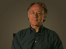
Graham Hancock
Graham Hancock is a British writer known for his research into ancient civilizations and mysterious phenomena. His works delve into the mysteries of human history and culture, including ancient Egypt, the Maya, and Atlantis. more
You May Also Like
Source: Maphead: Charting the Wide, Weird World of Geography Wonks
Source: Underworld: The Mysterious Origins of Civilization
Source: Underworld: The Mysterious Origins of Civilization
Source: Underworld: The Mysterious Origins of Civilization
Source: Underworld: The Mysterious Origins of Civilization
Source: Underworld: The Mysterious Origins of Civilization
Source: Underworld: The Mysterious Origins of Civilization
Source: Underworld: The Mysterious Origins of Civilization
Source: Underworld: The Mysterious Origins of Civilization
Source: Underworld: The Mysterious Origins of Civilization